Contact Mr. Kameika:
thomas_kameika@gwinnett.k12.ga.us
(Copy + Paste address into your email)
**Puede mandarme mensajes en espanol, si prefiere.

GIVE's Website: GIVE Center West


Jerusalem
__________________________________________________________________________


FRIDAY - August 26, 2011

 
GEOGRAPHY:

   Hi people!  Today was our test in geography.  If you were absent, you have until next Friday to take it!  Thank you :O)

WORLD HISTORY:

   Hi people!  Today we started our unit on Egypt!   Check out the slides below to see what we worked on today!


THURSDAY - August 25, 2011

 
GEOGRAPHY:

   Hey guys!  Today we basically reviewed everything we've done in geography up until now in preparation for tomorrow's test.  Please make sure you review the blogs below starting with the first week of school!

WORLD HISTORY:

   Well hello!  So, today we worked more on learning about Mesopotamia and looked at pictures, took notes, reviewed, and discussed.  See slides below to see what we did....


WEDNESDAY - August 24, 2011

 
GEOGRAPHY:
  
   Hey people!  Today, in geography, we started by watching a video clip of yesterday's earthquake that some of us felt here in Atlanta.  We discussed how earthquakes happen and many of us already knew how this worked!  It is Plate Tectonics!

   After this, we reviewed yesterdays' lesson on Earth's Rotation & Revolution.  And after that, we learned about Latitude & Longitude and how they are measured.  To find this out, click on the video clip to see.  Also, this video clip explains how they come up with the Latitude & Longitude degree numbers

   NEXT, play the GAME here to practice your Latitude & Longitude knowledge!

   Remember, there will be a test on Friday!

WORLD HISTORY:

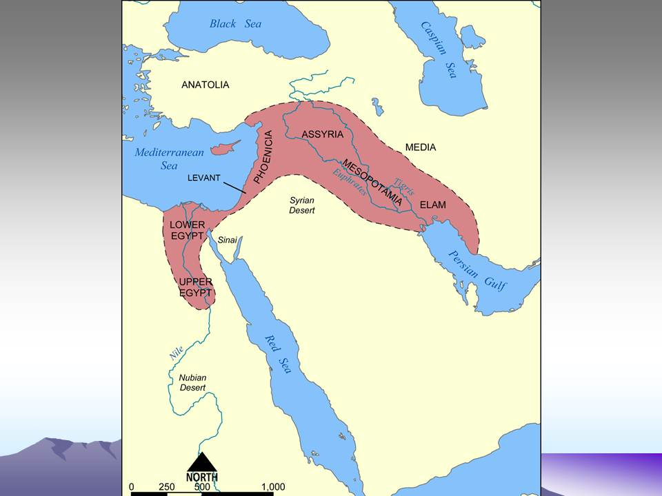
   Hey people!  Today, in world history, we started our unit on our FIRST civilization:  Mesopotamia.  Please check out the slides below to see what we learned about them.  ALSO!  Be sure you know the following vocabulary terms from the slides:  Cuneiform, Theocracy, Polytheistic, Hammurabi's Code, and City-State.


TUESDAY - August 23, 2011


GEOGRAPHY:

  HELLO!  Today in geography, we continued learning about The Great Circle Route (see blog entry from yesterday below for pictures.)  After this, we learned about Earth's Rotation and Revolution.  First, we had some students describe how this worked.  Next, we used the globe and the light coming in from the window, and then we used a YouTube video, which you can see by clicking BELOW...

     - What causes Earth's seasons?
     - Earth's Rotation / Revolutions.

WORLD HISTORY:

   HELLO!  So, today in world history, we finished our projects FINALLY and critiqued them using a rubric.    
  

MONDAY - August 22, 2011

 
GEOGRAPHY:

   Hey guys!  Today in geography, we reviewed Map Scale and Time Zones.  If you are not sure about these, check out the blogs below to find out more.  We also learned about "The Great Circle Route."  This is kind of a weird thing that we used maps, globes, and string to figure out.  Mr.Kameika asked that we put the end of a string on ATLANTA on a map on the overhead.  Then the rest of the string was used to show the shortest route an airplane would take to get to, say, TOKYO.  This was, obviously, a straight line. 

   NOW!  We used these strings to do the same route on our globes.  The shortest routes turned out to be curved instead of straight lines!  This is because the world IS NOT FLAT like the map on the board!  Flat maps are actually not to scale and show the world distorted in ways that do not perfectly represent size.  See the maps below to check this out!

So, why is it that a flight from Los Angeles to Paris (above left) goes in an arch instead of a straight line?  Or a flight from Chicago to Beijing, China (below) goes over the North Pole?  It looks like a straight line, no??  Well, imagine that this globe was stretched out into a regular flat map.... the line would look like an arch to us then!


WORLD HISTORY:

   Hey guys!  Today in world history, we finished our final drafts of our Civilization Projects.  We did this in the Media Center and you can check out some of the images below from our day.  REMEMBER!!!  Tomorrow you will judge the work of the other group and they will judge your work and give you a grade!!!

FRIDAY - August 19, 2011

 
GEOGRAPHY:

    Hello people!  Today, in geography, we continued learning about Time Zones.  To do this, we used destinations around the world that we picked of places we'd like to go to!  With these destinations, we figured out the following:

   1)  What time is it in ____?
   2)  If my flight is __ hours long, when will it arrive?
   3)  If my flight gets there at ___, how long did it take?

 To figure some of these out on your own, you can use the timezone map here:


WORLD HISTORY:

    Today, we went to the Media Center and worked on finishing our Civilization Projects.  HOMEWORK!!  If you have not finished your portion of this project, your homework is to finish this part over the weekend so that you can put the finishing touches on Monday in 15 minutes or less.
 

THURSDAY - August 18, 2011

 
GEOGRAPHY:

   Well hello!  So, today in geography, we were not able to go to the computer lab like we thought we would.  SOOOO!  We changed things up and, instead, we learned about Map Scale.  This means that we were learning how to look at a map and tell how far apart and how big (or small) things are.  If you were absent, follow the steps below, using a blank sheet of paper...

   1)  Draw a map of your route to your farthest class period from
         Mr.Kameika's classroom.  (draw both rooms, hallways, and
         other doors that you pass along the way.)
   2)  Write the number of steps you think it takes to get down the
         hallway to that other room. (basically, the distance)
   3)  "Walk" your map (count your normal paces, not feet.)
   4)  Now, re-draw your map on the back according to the correct
         measurements.
  
WORLD HISTORY:

   Well, hello!  So, today in world history, we started our Civilization Projects (yay!)  Click the slides below to see the scenarios, examples, and tasks to choose.  Today, we chose our groups, tasks, and began rough drafts of our tasks.

(Keep these details in mind as you work on your task.)
 
(Example of final product)

(Tasks)
(Great example of a Civ. Project from last year)

(Civ. Project with some great work, and some incorrectCan you spot what was not done properly?)

(Civ. Project with 3-D "Advanced City")

Guess who!
 

WEDNESDAY - August 17, 2011

 
GEOGRAPHY:

   Well hello!  So, today in geography, we continued with our Essential Question"How does geography affect culture & identity?"  To do this, we finished looking at the PowerPoint of our "7 cultures" (see slides below) and we discussed the projects that we will begin tomorrow.  You will choose only 1 out of  a list of 10 projects choices.  These projects are each about a different type of people somewhere in the world.  Using the internet, you will research and create a small project on PowerPoint to show how the geography where these people live has made them who they are--Unique!

   After this, we went to the Media Center and picked up our geography textbooks to take home.


WORLD HISTORY:

   Very niiiiice!  So, today in world history, we started with our "Vocabulary Windows" to define the following 3 terms:  Paleolithic People, Neolithic Revolution, and Neolithic People

   After this, we discussed and went over the instructions for our upcoming "Create a Civilization" Project (which we will start tomorrow.)  See slides below for instructions/examples. 


TUESDAY - August 16, 2011

  
GEOGRAPHY:

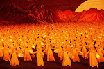
    Hey there!  So, today in geography, we began by watching a short clip of the "Mass Games" from the secret and mysterious communist country of North Korea (click here to watch.)  We then began to talk about North Korea vs. South Korea, and discussing the following question:  How does geography affect our culture and our identity?  To learn more about this, we looked at PowerPoint slides and video of several cultures around the world.  Click below to see them!


WORLD HISTORY:

    Hello people!  Today, in world history, we started with a "Civilization Walk."  To do this, we started again with using our imagination that we were suddenly the only survivors (for a 300-mile radius) of a global disaster in which all man-made things were destroyed.  We decided that the first thing we needed was WATER, and the second priority would be FOOD.  So, we went outside in search of WATER.  We found some water running off the roof and saw that the water was flowing to the West!!!  We realized that water DOES NOT ALWAYS FLOW SOUTH!!  We discovered that water flows DOWNHILL because it is pulled by gravity towards the center of the Earth (like all things).... and that sometimes hills slope down towards the East, West, and North. 

   We walked further and found where a stream flows on the other side of campus.  We decided that we would follow this stream to a larger river (downhill, of course) and that there we would hunt animals that also came to the river to drink, eat plants that grew in the fertile soil, and hopefully meet other people. 

   In this state we were what are considered to be "Paleolithic People."  We were hunter-gatherers and nomadic (see the slides below for definitions.)  In history, at around 8000 B.C., women discovered plants growing out of their kitchen trash piles and realized that the seeds in the scraps they had thrown out were growing new plants.  It was here that they discovered FARMING.  This is called the "Neolithic Revolution."  These Paleolithic People began to farm, corral animals, make new tools, and eventually became less nomadic.  They became known as "Neolithic People."  It was then that their population began to grow and they started to form large Civilizations.  For descriptions of all these, see the slides we looked at in class below....


MONDAY - August 15, 2011

  
GEOGRAPHY:

   Well hello there!  So, today in geography, we did the following:

     1)  Reviewed the oceans & continents.

            - We did this by jumping around again on the map on the floor.

     2)  Learned the Cardinal Directions (N/S/E/W)

            - We did this with discussion about how if we were ever lost, how
               would we find our way home?  We discussed how the sun rises
               in the EAST and sets in the WEST.  We then talked about how
               to find out which ways were NORTH and SOUTH....
            - To find NORTH & SOUTH, we used the phrase:  "Never Eat
               Soggy Waffles" by starting at the top of the compass and going
               clockwise (N/E/S/W.)

       3)  QUIZ - We finished by taking a short quiz on the continents, oceans,
              and cardinal directions. 

WORLD HISTORY:

    Well hello there!  So, today in world history, we started by taking a short quiz on the timeline we did in class last week.  The quiz consisted mostly of mathematical questions pertaining to certain events and dates on the timeline.  After this, we discussed the quiz questions.  Finally, we discussed, using a PowerPoint (slides below) how human beings "emerged" and evolved.  We started with the "BIG QUESTION" that people often ask:  Did we, or did we not, evolve from monkeys?  Not sure?  See the slides below for your answer!


   Also!  When we finished the quiz, each person turned in their quiz and went up silently to the board where there was a big blue sheet with a question on it.  The question was:  "What makes us civilized?"  Instructions were to write down any things and/or ideas that could help us answer this question tomorrow in class when we define "civilization."  (see pics of yourselves doing this in class below!)


FRIDAY - August 12, 2011

 
GEOGRAPHY:

   Well hello!  So, today in geography, we started out by each getting a big piece of weird-shaped paper.  Each of these pieces was a cut-out of a continent or an ocean.  Mr.K had everyone get on the floor in front of the room and try to put this puzzle together.  After it was done, Mr.K picked up the oceans and left only the continents.  He then gave everybody some BLUE TAPE to outline each continent on the floor.  When everyone finished, we picked up the paper continents and had an outline of the continents on the floor.  With these, we played "World Hopscotch" by shouting out different continents and oceans to the person who was jumping on the map!  See below for the pics!


WORLD HISTORY:

   Well hello!  So, today in world history, we did the following:

     1)  Reviewed the TIMELINE on the board from yesterday.
     2)  Took the World History PRE-TEST from the County.